Wednesday, July 18, 2012

Day 57 - Evolution Creek


June 21, 2012
Day 57
Miles: 21
Total Miles:  863

I hiked along Evolution Creek most of the day today and crossed paths with IPod, Sanjay, Creeper and Twisted throughout the day.  I Positioned myself three miles from Selden Pass at only 11,000 ft.  The Muir Pass was the last 12,000 foot pass on the trail - it's all down hill from here!

click to see full size image
After Selden Pass I have about 16 miles to VVR (Vermilion Valley Resort) Lake Trail which will take me 1.4 miles to the lake, a ferry ride across to the resort and a restaurant meal and shower!  I have to make it to the lake by 4:30 tomorrow to catch the ferry - no problem.  
The trail today showed me some great waterfalls - some careening off of granite cliffs thousands of feet up off the valley floor.  I also ran across several trail maintenance crews clearing the trail of downed trees from winter storms.  Without these crews, it would be quite a different, and more difficult, hike.

Today is "Hike Naked Day" and the Summer Solstice.  I'll spare you any pictures...  :)

Day 56 - Muir Pass


June 20, 2012
Day 56
Miles: 17
Total Miles: 842
Self-Portrait on Muir Pass
Muir Pass was impressive - the best yet!  The climb was a long one:  ten miles of ascending from 8000 ft to 12,000 ft.  Around every bend was a new alpine lake, a snaking river or another amazing view!  There were several snow crossings on the way up as well - unusual this year.  Several times I came up to a peak up ahead and anticipated the summit only to be shown a much taller peak - false summits!  But I was never dissapointed with the accompanying views.


Sunset over Sapphire Lake after Muir Pass
Finally at the top - I found Creeper and Twisted exploring the Muir Hut, which was built by the Sierra Club to honor the contributions of the founder - John Muir.  I was tempted to sleep in the hut but instead decided to hike down four miles to Sapphire Lake and set up camp as the sun set over the lake.  I found a nice spot and snapped some pictures of the sun reflecting off the lake.  

Jamaican Jerk Rice & Chicken and some green tea for dinner.  A fantastic day!


Day 55 -Two Passes


June 19, 2012
Day 55
Miles: 21
Total Miles: 825

click to see full size image

I hiked over Pinchot Pass and Mather Pass today.  After Mather Pass there was a long slog down past the Palisade Lake on the "Golden Staircase".  This section of trail descends down a cliff face very steeply.  The trail is cut into the cliff and many spots are extremely steep and winding.  Here is a link on the staircase with it's history.  This section was the final section of the John Muir Trail completed in 1938.  I hiked down the staircase in the evening after already hiking 18 miles over two passes earlier in the day.  My feet were really sore and if I knew about the descent before I climbed down it I probably would have camped at the lake instead.

Sierra Waterfall
But I can't complain, for I just climbed over two gorgeous passes on the JMT - arguably one of the most scenic trails in the world!  There is a saying that I recently read concerning another long distance trail - the CDT (Continental Divide Trail) - that says "Embrace The Brutality".  It refers to the point you get to on a long-distance hike where you know you can handle anything and everything thrown at you.  Once you're out here for weeks on end and have experienced the gail-force winds, desert heat, cold and frosty nights and bone-chilling river fords enough times you gain a sort of confidence that you will make it through and cope with whatever conditions you find yourself in.  And once you begin to embrace that, you can relax and let go of the fear and enjoy the knowledge that you will get through it no matter what it is and you will be rewarded.  I think I am beginning to get to this point.  It's an incredible feeling to know you can handle it - whatever it is.  The feeling of freedom that comes from this is amazing.

Wednesday, July 11, 2012

Day 54 - Slow Progress


June 18, 2012
Day 54
Miles: 14
Total Miles: 804


Threshold taking a brief rest
The three of us made slow progress today.  The altitude and a couple of days off must be slowing us down.  Also, the constant climbing and descending really takes it's toll in the Sierra's.  We took many breaks and felt exhausted and frustrated with our slow progress.  Finally, after an early evening break and a meal of linguine and tomato/mushroom sauce, I felt energized and pounced up six miles of trail toward Pinchot Pass feeling strong.  I need to eat more pasta on the trail!

I camped tonight partway up Pinchot Pass and enjoyed a fire with Sid and Thresh.  The mosquitos have been horrendous since Charlotte Lake and the fire, along with copious amounts of Deet, helped dissipate the little devils.


On a break

Sierra Lakes

Passing the 800 mile point of the trail!

Day 53 - Back on the Trail


June 17, 2012
Day 53
Miles: 0 PCT miles (9 miles on Kearsarge Trail)
Total Miles: 770

Hitching out of Bishop
We hiked in on Kearsarge Trail today after getting a late start at 4 PM.  From Bishop we hitched in to the town of Independence and caught a ride with a father and his teenage son who were on their way to Los Angeles after a day of hiking.  Sid, Thresh and I piled into his van and we soon passed Banana Pants looking desperate for a ride.  The father graciously offered to stop and pick up B.P. as well and soon there were four of us in the van heading to Independence.  

Back on the trail after a quick pit-stop at Uber-Bitch's trail angel camp site, we made our way back over the pass and down a mile and a half to Charlotte Lake where we planned on camping for the night.  We encountered a little kink in our plan:  as Threshold and I stood and discussed bear canister strategy she loudly proclaimed "there is a bear RIGHT THERE!".  I turned around and sure enough, a large bear was sauntering not 30 feet from us in the trees, slowly making it's way through the trees and not making a sound (I would never have known he was there had Threshold not seen him).  It was getting dark but I could make out it's size - at least up to my waist standing on all four paws, but probably bigger.  

Siddhartha pulled out his camera and ran after in the direction the bear walked but was not able to find the bear and lost his chance to see his first bear of the hike.  I snapped a quick shot with my compact camera but in the dark the picture did not come out clear.  Immediately we decided to hike another half-mile down the lake and search for the bear box that was supposed to be available next to a ranger station.  We found the bear box and after eating we laid out bags down in a row and cowboy camped next to the lake.

Preparing to hit the trail at the Kearsarge Trailhead

Days 51-52 - Zero in Bishop


June 15-16, 2012
Days 51-52
Miles: 0
Total Miles: 790

Siddhartha, Threshold and Highlife enjoying a zero day
We finished out hike out over Kearsarge Pass today, from the Kearsarge Lake campsite to the trail head  where a parking lot beckoned us from below with trail magic - through word of mouth passed along from hikers coming back up the trail from town.  I almost ran down the last two miles of trail with visions of soda and brownies and fruit in my nutrition-starved head!

When I got to the trail-head and parking lot, I made my way to the neighboring campsites and found what I was looking for - Uber-Bitch had a table with cookies and M&M's and fruit and she offered a beer as well!  After relaxing and eating half of her bowl of M&M's we thanked her profusely and got a ride down into Independence from Sleeping Bear - another trail angel running hikers back and forth to town from the trail.  We hitched from Independence - a small one-street town - to the town of Bishop 50 miles away and booked a room at the Motel 6.  Threshold, Siddhartha and I shared a room and we proceeded to shower and launder our clothes.  What a feeling a hot shower is after seven days on the trail!

The next couple of days were spent eating and drinking - at the Whiskey Creek restaurant where we had steak and asparagus and at the famous Schat's Bakery where I enjoyed breakfast and coffee and pastries, and then back to Whiskey Creek the next day for happy hour, and then back to Schat's the next morning for another breakfast!  I did actually get a few things accomplished besides filling my belly with food and beer.  At the local outfitter, Wilsons, I replaced my gaiters with a pair of Mountain Hardware gaiters and purchased a new ultra-light wool blue long-sleeve shirt to replace my synthetic shirt which was at the end of it's dirty life.

Siddhartha at Motel 6


Finally - a proper steak dinner

Day 50 - Forrester Pass


June 14, 2012
Day 50
Miles: 20
Total Miles: 790
Siddhartha, me and Threshold on top of Forrester

Today the four of us - Siddhartha, Denise, Threshold and I - hiked up and over Forrester Pass.  Forrester Pass is the highest point on the Pacific Crest Trail at 13,200 ft. in elevation.  The pass was daunting viewing it from below.  I see a huge granite wall with a large steep rock fall in front of you and could't imagine where a trail could take me to the top.

Soon though, as we climbed closer to the wall, a faint trail appeared weaving through the rock fall.  The climb up was steep but soon I was standing at the top and taking in the view of Kings Canyon National Park to the north and Sequoia National Park to the south.  In past years climbing this pass would have required traversing a steep snow bank near the top of the pass - an often treacherous crossing requiring an ice axe and micro-spikes.  This year, however, the snow was melted and no crossing was necessary. This year is an almost recored low snow year and crossing over snow in the passes will be rare and I have not carried an ice axe or micro-spikes.

Climbing down into Kings Canyon N.P. into the tree line was impressive as the views never stopped.  I winded my way down next to a river with the canyons towering above me to the left and right.  At the Kearsarge Pass trail we left the PCT and hiked toward Kearsarge Pass toward our destination the next day - the town of Independence and then a hitch to Bishop for a zero day.  We camped for the night at Kearsarge Lake after rain and thunder clouds threatened us from the high peaks.

Hikers climbing toward Forrester Pass


View north from the top of Forrester Pass


Siddhartha and I camped out at Kearsarge Lake


The views in Kings Canyon N.P. never stopped!

Tuesday, July 10, 2012

Day 49 - Mt. Whitney Sunrise!


June 12-13, 2012
Day 48-49
Miles: 14 (+18 on Whitney Spur Trail)
Total Miles: 770


Sun rising on top of Whitney

I will forever remember summiting Mt. Whitney - absolutely amazing!  

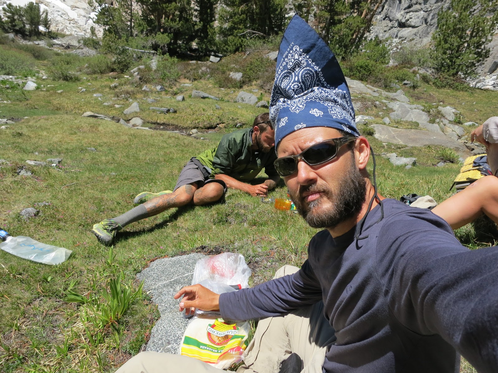
On June 12 I hiked to Crabtree Meadows and the spur trail that leads to the top of Whitney.  Another mile up the spur trail leads to the Ranger Station and Upper Crabtree Meadows.  After several solo days it was great to see so many familiar faces at the meadow - some had hiked to the top already and were resting before moving on.  Others were preparing to summit the following day.  I made plans to do a sunrise summit with a group of other hikers that I had the privilege of suffering through many desert hikes with.  The plan:  crawl into my tent at 6 PM, wake up at midnight and hike up 4,000+ feet of elevation to the top of Whitney - in the dark.  The afternoon was relaxing - washing laundry in the river, watching a marmot dance in the meadow and bask in the sun, and eating Annie's shells and cheese dinner.  I learned that others were camped three miles up the trail at Guitar Lake - I would likely see them tomorrow at the top.

Fairway set the pace for the first 4 miles.  At 12:45 AM we met by the river with our slimmed-down packs:  only down jacket, gloves, hat, long-underwear and camera.  The rest of my gear was stowed in my tent in the trees next to the meadow.  Breakfast was cold oatmeal with dried fruit out of a zip-lok bag, and a Cliff Bar.  Yankee Son, Fairway and I made our way up mostly gentle inclines for the first few miles at a blistering pace.  Fairway led and Yankee Son and I kept up through the dark - headlamps flashing this way and that to keep us on the right trail.  The gloves and hat soon came off as the effort of hiking heated my body up despite the cooling night air.  Water was flowing and swishing all around us and trees disappeared - we must be passing Guitar Lake and it's river inflows and outflows.  Guitar Lake is above the tree line so though we could not see it, we knew we were passing it in the dark.  

Then the switchbacks started.  We were climbing now, steeper and rockier than before.  Fairway was pushing too hard and I had to pause for a breath and a moment of rest.  I let them hike on at a corner of one of the switchbacks and I was happy to catch my breath.  Behind me I heard a shuffling but no light - shining my headlamp back I saw Wasabi approach in the dark.  Her lamp had run low on batteries and she was feeling her way up the switchbacks in near darkness!  I told her to follow me and we made our way slowly up the rocky path - her following close behind.  

The climb was brutal the rest of the way - often climbing between rock cliffs and several times traversing over or near snow fields.  Wasabi was struggling to see the trail and was going to give up and sit on the trail wrapped in her sleeping bag.  I suggested she walk in front of me so that my light could illuminate the ground for both of us.  This worked beautifully and we trudged on.  The air grew cold and every time we stopped, we chilled to the bone.  At one point she exclaimed "why did I ever think it was a good idea to climb this silly mountain" in her thick New Zealand accent.  I knew what she meant and at that moment I was tired and miserable and couldn't help but agree.

But soon the trail began to level and we knew what that meant.  We were close!  Wasabi checked her altimeter and it read 14,000 ft - only 500 feet to the top!  A hut appeared in the distance - built by the Civilian Conservation Corps in the '30's.  Shadows up ahead were moving and voices echoing off the rocks.  We arrived at the top of the continental United States at 4:40 AM, at an altitude of 14,491 ft.  The cold was bitter as we bundled into all layers of clothing, and sleeping bags if we had them, and waited for the sun to make an appearance.  Bronco shared his sleeping bag with me as I had failed to consider it would be this cold on Whitney's summit.  

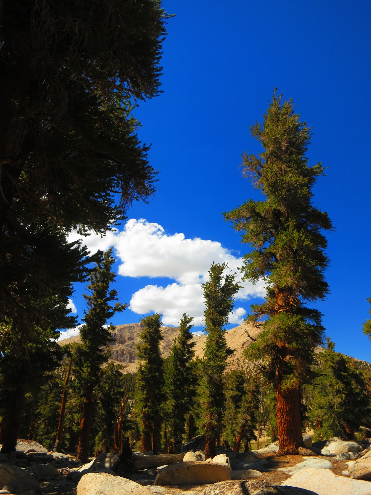
Soon though, the light began to illuminate the mountain peaks in the east and cast a dark shadow to the west - it was Mt. Whitney's shadow on the mountains.  Amazing views started to fill in around all sides of the peak.  

Yankee Son & Hallmark staying warm

The Views!

Capturing the perfect shot

Happy to be at the top of the world!

self-portrait descending Whitney

Ben waiting for me at Guitar Lake


The hike down was gorgeous now that I could see the views.  I passed Siddartha, Threshold and Ben on the way back.  Others were also climbing to the peak as I was coming down.  I arrived at my tent at Crabtree at 10 AM and jumped in my tent for a three hour nap.  

That evening I hiked out of Crabtree Meadows at 5 PM - Fairway, Yankee Son and the rest of the group had already hiked on.  Where-as yesterday the meadow was bustling with hikers, today I woke up to just one hiker remaining - he had an injured ankle and was resting.  Hikers often come in waves and this was the case today.  I hiked the 2 miles back down to the PCT on the Whitney Spur trail and hiked on for four miles to Willow Creek.  Threshold and Denise (a section hiker) were camped already and Siddhartha wandered in later that night and camped with us.  We had a "tea party" amid the swarming mosquitoes and then settled in for the night. 


Day 47 - Chicken Meadow Lake


June 11, 2012
Day 47
Miles: 20
Total Miles: 756

click to enlarge picture
I'm taking lots of pictures today.  I stopped for lunch at Poison Oak Spring and then walked another four miles to Chicken Meadow Lake.  The lake is cold but I waded in up to my knees and washed my legs and then sun-bathed for a while.  In the desert it was all about covering up and avoiding the sun.  now I am able to bask in the sun's rays and try and get some color to correct my severe farmer's tan (hands and neck are brown, everything else is pale white!)  I'm also seeing clouds today for the first time since the start of the hike!

Although I ran into Threshold, Shameless, Chicken Little and others at lunch - tonight I'm camping solo again near the two small lakes that look like footprints on the map.  I climb Whitney tomorrow!


Day 46 - Hiking in "The Range of Light"


June 10, 2012
Day 46
Miles: 20
Total Miles: 736


A solo day of hiking but I'm loving it!  Only one person passed me sitting on the side of the trail eating lunch - Tuna Helper.  Tuna Helper is attempting a record thru-hike of the PCT of under 60 days!  He started at the border on May 25th and is already 725 miles down the trail 15 days later.  He said he is averaging 44 miles/day in the desert and his goal for the Sierra's is 35 miles/day.  Now that's nuts!  My biggest mile day to-date is 30 and that was one hell of a long day.

I'm camping alone tonight at 10,500 feet.  Tomorrow I will get up to 11,500 ft and hover around that altitude until I get to Mt. Whitney at mile 766.


Day 45 - First Day in the Sierra's


June 9, 2012
Day 45
Miles: 14
Total Miles: 716

After two miles of sandy walking, past the Kennedy Meadows Camp Ground, I'm finally here.  Beck's Meadow is beautiful and a welcome sight to my desert-weary eyes.  It feels like a completely different hike now - green, wet, trees and water...lots of water.

I arrived at the Kern River and camped nearby.  Wampass Cat, Zen, iPod and others had arrived and already had a fire going - my first campfire of the trail!  I'm excited about what's to come in the Sierra's...

First views of Beck's Meadow


Bridge of Kern River


PCT Northern Terminus

PCT Northern Terminus
On September 30, 2012 I reached the Northern Terminus of the Pacific Crest Trail. Thanks to everybody who supported and followed my journey. It was a life-changing experience!