Sunday, December 2, 2012

Day 142 - The Knife's Edge, Goat Rocks Wilderness

September 13, 2012
Day 142
Miles: 20
Total Miles: 2303

Let me just post some pictures because really, words don't do this section justice.  Enjoy!


Mt. Adams Through the Wildfire Smoke

Mt. Adams at Sunset with Blackbeard looking for an optimal shot

Old Glory and Mt. Adams

The Knife's Edge and Mt. Rainier with the sunrise

Siddhartha perched on the Kife's Edge Taking in Mt. Rainier

Morning Fog near the knife's edge

Having a great time despite my crazy hair and beard!

Saturday, December 1, 2012

Day 149 - Climbing Cathedral Peak

September 20
Day 149
Miles:  20
Total Miles:  2458


Cathedral Peak from Deep Lake

After seven miles of hiking, Siddhartha and I take a break together near Deep Lake in the Northern Cascades.  As we eat, he half jokes that we should take another side trip and climb Cathedral Peak - the large mountain looming in front of us.  I had wanted to summit another mountain since summiting Three-Fingered Jack back in Oregon, and his comment got me thinking of the possibilities.

"Are you still thinking of climbing that peak"?
"No, I want to get to Steven's Pass early tomorrow so I don't have to take a zero" came the reply.

And then I hike on, leaving him to finish his food.  When I get to the east side of the peak as the PCT winds around and to the north, I stall.  "Well", I tell myself, "I'll just see how far I can get before it gets too steep.  Just a fact-finding mission".

So I take my first steps toward Cathedral Peak.  Regardless of what I tell myself, I know that once I start up this peak I will not stop until I reach the summit.  However, at each increased level of difficulty; when dirt trail turns to steep switchbacks, when switchbacks turn to rock scrambling, when rock scrambling turns to climbing through a narrow rock chasm, when that turns to actual rock wall climbing, I justify going further by telling myself, "let's just see how far I can go".

Cathedral Peak from the PCT
And an hour and a half later I am a mere fifty feet from the summit, on a rock wall sloping maybe 10-15 degrees from vertical, taking a picture of Deep Lake below me.

I take the "I'll just see how far I can get" mantra as far as it will take me.  Here on this precarious perch below the summit, fear takes hold and gets the best of me.  Like Three-Fingered Jack, much of the climbing up Cathedral Peak is exposed, and I was risking my life - albeit a calculated risk.  However, unlike TFJ, I am alone.  A fall or injury would be serious with no one to help me.  Also, there is no one to guide me down the wall from the summit if I find myself trapped.  I fear coming down more than I fear climbing up.  These factors kept me from reaching the summit.

Fear is neither good nor bad, but just a mechanism for survival.  Many fears in society come from irrationality, false information, prior trauma or other bad experiences.  These fears are not life or death responses, but often people live restricted lives based on these irrational fears instead of facing them head on - which is often the best way to move past them.  Leaving my job and embarking on a five month hike of the PCT came with many of these irrational fears.


A near vertical snapshot of Deep Lake below me

But fear on the top of a mountain is direct feedback - your body and mind are communicating that you are in threat of physical danger and you should take caution; flight or fight.  This is the fear I listen to, and at this moment,  balancing on the side of an almost vertical rock wall alone, fear was telling me to get down off that mountain.  I'm glad I listened to my instincts, for far too often people ignore instincts and make grave errors in judgement.

Though I did not make the summit, I feel great about my accomplishment.  I also realize that to succeed in these climbs I need the correct gear and the proper training.  Taking a rock-climbing course is high on my agenda post-PCT.

Cathedral Peak from halfway up the climb
After an exhaustive search for my pack that I had ditched on the way up the mountain, I finally reach the PCT and walk on.  Ironically, a mile down the trail while casually hiking and searching on my I-Pod for music, I mis-step and tumble off the side of the trail, my left foot landing on a soft dirt shoulder, sliding down quickly and taking my body with it five feet down a steep hillside!  After being focused and on high alert during my sojourn up Cathedral Peak, I had relaxed my focus too much, let my guard down, and the result was me splayed face first in the bushes with my pack up over my head, arms still strapped in.  After brushing myself off I laugh at this turn of events and keep walking.

I hike ten more miles that day over Deception Pass, meet up with another hiker, Amigo, and reach the Deception Lakes before dark.  Log, a section hiker, Amigo and myself camped at the lake that night and traded stories of the trail.  What a life I live!


Looking up the Rock Wall to the Summit


Friday, November 30, 2012

Day 109 to 112 - Life is Easy in Ashland


August 12-15
Day 109-112
Miles:  71
Total Miles:  1727

Hiker Gathering at Siddhartha's Parents House

After Seiad Valley I made quick progress, reaching the Oregon Border (miles 1702) a couple days later, and then to Ashland where Siddhartha's parents graciously took several of us in for a couple days.  This was a great place to relax and take a zero.  Others were taking a break in town so we  threw a BBQ-Jubel, Bobcat, Amigo and the other Istreali, Weather Carrot, Washout and Threshold all had a great time.

Wednesday, November 14, 2012

Day 128 - Facing My Fears on Three-Fingered Jack

August 31, 2012
Day 128
Miles:  15
Total Miles:  2021

On Top of Three Fingered Jack


The morning of August 31st, I crossed Highway 20 at Santiam Pass before making my way up the trail toward Three-Fingered Jack six miles farther, distinguishable by it’s many peaks jutting into the sky.  At 7,481 feet, TFJ is not the tallest volcano in the cascades, but it is never the less a very distinguishable and dramatic form visible from hundreds of miles in either direction.  It is said to have three primary pinnacles, thus the name Three Fingered Jack, but seen from the south it is not obvious which of the many spires are the namesake three.  

The PCT passes west of the summit where it connects to a spur trail which leads to the base of the mountain and there I find a piece of Day’s Inn stationary snagged from our Bend hotel room, placed under a rock.  Siddhartha’s scribbles are scrawled across it:  

Monday, November 5, 2012

Day 107 to 108 - Seiad Valley and the Goff Fire

August 10 to 11
Day 107-108
Miles:  38
Total Miles: 1656

Wildfires west of the PCT
The next two days were spent winding toward the small town of Seiad Valley which sits a few miles from Grider Creek and less than fifty trail miles from the Oregon Border.

The descent down Grider Creek Canyon was long, about fifteen miles, which began by gently criss-crossing dirt roads and than descending more earnestly down a deep canyon into thicker vegetation and a canopy of trees:  thimbleberries, and wild blueberries became more abundant and poison oak cropped up along the trail.  The Madrone (Bearberry) Tree with it’s thin layers of orange-red bark peeling away in sheets appeared as I neared the first of four wooden bridges spanning the creek.


Thimbleberry plant
The Madrone Tree
As I made my way down the steep-walled canyon, the air got thicker and the humidity increased.  Walking by several waterfalls and bounding over creeks I felt like I was walking through a South American rain forest.  The steep walls began to give way as I neared the fourth bridge crossing and I knew I was not far from to the Grider Creek Campground where I would camp for the night alone.  Just six miles of road walking, the longest road walk of the official PCT, separated me from the community of Seiad Valley.

The next morning Weather Carrot walked into my camp as I was packing up my tent and rinsing out my coffee mug, having camped at the second bridge crossing over the creek a few miles back.  We walked the road together, pausing here and there to sample the abundant blackberries, and made it to town for breakfast at the cafe.  The town of Seiad Valley consists of the Cafe/General Store and a campground that hosts hikers who can camp at a discounted rate.  The store accepts hiker resupply boxes where mine was waiting for me after breakfast.

I took a shower at the campground and then picked up my resupply box and made preparations to leave that afternoon.  As I was doing my resupply Siddhartha and Threshold hiked in!  I hiked with these two from Mt. Whitney through much of the Sierras until we split up before Muir Pass, so it was good to see them again.  Washout, another hiker I had not yet met, rolled into town with them.

During lunch at the same cafe, we were debriefed by area firefighters on the Goff fire raging west of the trail.  The status was evolving and changing every hour - one volunteer firefighter came by the campground and told us we would have to take an alternate road walk that by-passed the first eight miles of the trail.  An hour later, another came and told us that in fact, the trail was not closed and we would be safe as the fire was still several high ridges to the west of the trail and winds were favorable.  The debriefing at lunch confirmed this last update, so after several “beer” delays, the four of us hiked down the road toward the trail at 6 PM.  

Immediately after leaving the road, I split from the others and began a long climb from the road at 1400 feet up to a dirt road crossing at 5800 feet, covering eight miles of trail.  I ended up hiking well into the night reaching the campground at 11 pm.  The night hike was surreal as I watched the sun drop to the west behind ridges blazing with the Goff fire.  One by one I could see trees explode into flame as the fire burned up the ridge.  The brilliant colors of the sunset made all the more brilliant by the diffusive effect of the smoke spreading across the valleys.  Briefly I imagined flames racing toward me and smoke chocking me out as I became the first fatality of the 2012 season.  These thoughts were tempered by a realization that the prevailing winds were to the southwest, keeping the flames and much of the smoke moving in the opposite direction from the trail.  Still, I didn’t dare stop and camp before putting some distance between myself and the fire.


Once the sun dipped below the horizon and the flames retreated behind me, I hiked in almost complete darkness - any light from the moon and stars being drowned out by the lingering smoke in the air.  My world on night hikes typically extended only ten feet directly in front of me on the trail (the range of my headlamp).  Tonight the forests and hills revealed a new world coming alive and invading my reality:  large toads enjoying the cover of darkness found a place to rest on the path frozen by my headlamp (I nearly stomped on one the size of a baseball) and scorpions several inches long scuttled across the trail escaping my bright light.  Every noise in the trees jerked my neck in that direction searching for the source, looking for a shadow or a pair of glowing eyes.  Once I spotted these eyes glaring wearily back at me in what I believe to be a meadow, first one pair, then scanning the area, three additional pairs reflected off my headlamp-too narrow to be bear, too high off the ground to be fox or coyote-must be deer.  Owl’s hooted in the shadows and feet crunched branches and leaves in the forest.  I felt a strange combination of alertness and peace, I belonged in that wilderness as much as the animals around me belonged there.  My senses were attuned to the sounds and smells and sights just as they were evolved to do over millennium.  I was not a stranger walking through an inhospitable and dangerous land, but a creature of the earth re-connecting with his natural habitat after being steered away by a society that has developed an unnatural fear and uneasiness of wild places.

UPDATE:  As of August 24th, the Goff Fire officially closed a nine mile section of the Pacific Crest Trail.  On August 28th, just two weeks after I hiked through Seiad Valley, evacuation orders were given to the town.

http://www.mailtribune.com/apps/pbcs.dll/article?AID=/20120829/NEWS/208290319


Tuesday, October 30, 2012

Day 105 to 106 - Etna

August 8 - 9
Day 105 to 106
Miles:  5+12 (my best guess)
Total Miles:  1618


After a short hike to the road, Fall Risk and I caught a ride from someone from town who was dropping other thru-hikers back onto the trail.  We asked that he take us directly to Bob's Restaurant where we walked in, dirty and smelling of trail funk, and had breakfast.  The server, a middle-aged woman, did not look so pleased to be serving a couple of stinky hikers but she did all the same.  

Day 103 to 104 - Trail Magic and The Russian Wilderness

August 6 to 7
Day 103-104
Miles:  10+35
Total Miles:  1601


View from The Russian Wilderness
After just ten miles we made it Highway 3 where Unload was set up with a grill, picnic table and loads of beer.  Unload had hiked the PCT in 2011 and he had spent the winter on a fishing vessel up in Alaska.  He was back for the summer and decided what a better way to spend his time than to hang out with some green 2012 thu-hikers.  He cooked us burgers and dogs and we drank beer and soda and whiskey.  Even with only ten miles behind us that day, it took very little to convince us to stay that night and keep the party going.  Once other hikers showed up, Weather Carrot and Bobcat, we were in for the night.

Day 101 to 102 - Deadfall Lake and Gumboot Lake

August 4-5
Day 101 to 102
Miles:  20+24
Total Miles:  1556


On August 4th Jubel, Action Pack and I camped at Gumboot lake just a half mile off trail.  We briefly met another group of campers at the lake on a "vision quest."  Unfortunately, none of the vision questers invited us to join them at their delicious smelling meal.  None the less, we took advantage of the cool waters of the lake and took a swim to wash away the dust and grime - I washed my hair with Dr. Bronner's bio-degradable soap.  A deer seemed keenly interested in our tent site and we had to shoo it away several times.

Friday, October 26, 2012

Day 99 to 100 - Zero in Shasta

August 2
Day 99 to 100
Miles:  0 + 7
Total Miles:  1512

words to live by

Shasta is a fun little town on the I-5 corridor, saddled up next to Mt. Shasta.  Black Bear Diner was excellent for breakfast.  Yak's Cafe was a cool place to hang out and have coffee.  Burger King was Jubel's choice with $3/900 calorie milk-shakes and free wi-fi.

That afternoon we climbed into the truck of a friend of Action Pack and headed to Lake Siskiyou for some sunbathing, rope swinging and relaxation.  Mellow, Action and Smiles arrived at Shasta later that day and setup at the KOA campground, where we cooked chicken and burgers and corn-on-the-cobb.

The next day was full of good intentions to hike out of town and get back to the trail.  However, resupplying and hitching out of town took the majority of the day.  After trying to hitch near the Burger King for about an hour, we decided to walk across the freeway near the on ramp.  After another 45 minutes we secured a ride from a young man who looked like Albert Einstein (with crazy blonde hair and bad teeth).  This kid worked seasonally clipping and processing weed (an occupation that I learned occupy's more than one thru-hiker during the fall season!).  After generously supplying a small bag of weed to Jubel, we hiked seven miles to...I don't remember where!


the wrong way to hitch


that's better

Day 95 to 97 - Burney Falls to Shasta

July 29 - August 1
Day 95 to 97
Miles:  21+24+25+27
Total Miles:   1505


Burney Falls
Jubel and I hiked to Burney Falls Stat Park today, July 29th.  We caught up with others at the park store - Mellow Yellow, Action Pack, Smiles and others.  After a long six-hour siesta eating over-priced but still appreciated hot dogs, ice-cream cones and burritos, we hiked on to a bridge spanning a waterfall, where we camped.  Sleeping on a bridge is a treat because I get a flat spot and security from ants and other dirt dwelling insects, and the sound of the waterfall below is a pleasant white noise that puts me to sleep.  Besides we had no choice, the only other flat spot nearby was occupied by a couple thru-hiking with their seven-year old son, and we did not want to hike farther down the trail.

Monday, October 22, 2012

Day 93 to 94 - JJ's Cafe and Hat Creek Rim

July 27 -28
Day 93 to 94
Miles:  25+30
Total Miles:  1408


Mt. Shasta from Hat Creek Rim

The morning of July 27th started with a can't-miss breakfast at the Drakesbad Guest House.  Jubel and I then made an escape, leaving the camp near Drakesbad at 10:30 AM, feeling the pull of the trail.  Old Station was our next stop and we made it to the "trailer park" after a long flat hike past OHV roads, tree farms, hunting trails, far off gun-shots accompanying our hike much of the way.  Besides some great views of Lassen today, the scenery in trees and the trail flat.  The Old Station trailer park turned out to be a big trailer campground (I was imagining a retirement community) and the neighboring burger joint was closed when we arrived.  We cowboy camped in a pine tree forest past the trailer park on a thick layer of pine needles - a soft bed.

Friday, October 19, 2012

Day 92 - Drakesbad and Volcanic Gysers

July 26
Day 92
Miles:  18
Total Miles:  1353


Jubel the Outlaw at Boiling Springs Lake

After the amazing breakfast at the Pipers, we have just 18.5 miles to Drakesbad Guest Ranch in Lassen Volcanic National Park.  Drakesbad takes care of thru-hikers.  After serving their paying guests in their restaurant, they bring the food left un-consumed out to hikers on large platters.  For a mere $5 (or was it $10?) they fed us all we could eat of the turkey, bread rolls, veggies, bean salad, etc.  Joining Jubel and I was Lava Goat, Sierra and Happy Feet (both section hikers).

Day 91 - The Pipers

July 25
Day 91
Miles:  20
Total Miles:  1335


Jubel and I hiked twenty miles through some nice flat trail to reach Highway 89, where crossed the highway and...trail magic!  Two large ice chests full of gatorade, soda, fruit.  A note - Piper's Mom is offering rides and possibly a place to stay!

Day 90 - Entering the Cascades

July 24
Day 90
Miles:  25
Total Miles:  1315


First Views of Mt. Lassen at Sunset (center)

The climb out of Belden and the north fork of the Feather River was long - twelve miles - and took me to an altitude of 7,000 feet from a starting point of of 2,000 feet at the river .  I left, as planned, before that orange hydrogen flame-ball in the sky penetrated through the trees to the canyon wall where I would zig-zag up out of the poison oak covered canyon and reach, at last, the first volcanic rock encrusted ridges and peaks of the Cascades.

Monday, October 15, 2012

Day 88 to 89 - Belden

July 22-23
Day 88 to 89
MIles:  25+0
Total Miles:  1290

Deer stuck on a steep trail looking for an exit


After a great breakfast at Buck Lake Resort where we once again met Jubel (he had abandoned his attempt to reach Belden by Saturday after he was invited to join in on someone's camp at Buck Lake.)  We hitched the short mile to the trail and then headed toward Belden - a 5000 foot descent over seven miles.  Belden is a very small community

Sunday, October 14, 2012

Day 86 to 87 - Swimming in the Feather River

July 20-21
Day 86 to 87
Miles:  27+30
Total Miles:  1265

Lunch at the Feather River

Jubel left camp early the morning of July 20 - about 5:30 AM.  He wants to make it Belden by Saturday night for the rave.  Belden is famous for it's raves - all night parties that attract people from the surrounding towns.  Jubel would have to do two 42 mile days to get to Belden by Saturday.  Good luck with that!  I hiked alone today but managed to catch up to Lightweight

Day 85 - The Sierra Buttes Fire Tower

July 19
Day 85
Miles:  11
Total Miles:  1208


Jubel arrived in Sierra City today at about noon.  After he resupplied with food from the general store we accepted a ride from the Red Moose Inn owner to the trail, and then headed north up to the Sierra Buttes - a series of jagged crags overlooking Sierra City and upper and lower Sardine Lakes and surrounding valleys.  This was a steep hike but it soon revealed some beautiful views.

Saturday, October 13, 2012

Day 82 to 84 - Sierra City

July 16 - July 18
Day 82 to 84
Miles:  25+10+0
Total Miles:  1197


The Sierra City general store

My feet are still hurting after a week off and with the new Brook's Cascadia 7's that I picked up in Reno, but they are improving.  On July 16th I hiked solo all day, passing Fall Risk a couple of times but not catching the others who left the P. Grubb hut early the prior day.  I camped alone just pas Jackson Meadows Reservoir that night, just ten miles shy of Sierra City!

Day 81 - Donner Ski Ranch and the P. Grubb Hut

July 15
Day 81
Miles:  22
Total Miles:  1162


View of Donner Lake and Old HWY 40

Today I pushed hard to get to Old Highway 40 - Donner Pass - for lunch.  Just a half mile down the road at the pass is the Donner Ski Ranch serving sandwiches, beer and ice-cream.  As I arrived I see others sun-bathing on the deck - Peels, Beef Nugget, Mellow Yellow and others.  Once inside I met a group of hikers I had hiked with back in the Sierra for several days

Day 78 to 80 - Echo Lake to Donner Pass

July 13 - July 14
Day 78 to 80
Miles:  0+21 + 25 
Total Miles:  1140


Seven days off from a long distance trail can be a great opportunity to recover, but only a surface level recovery - In seven days my feet have only begun to heal.  The pain upon standing in the morning continued and actually became worse during this time.  Joint pain was increasing as well - my body must have recognized this first opportunity of more than a couple of rest days and decided I must be done with this business of hiking

Tuesday, October 9, 2012

Day 73 to 77 - Time Off

July 7 - July 11
Day 73 to 77
Miles:  N/A
Total Miles:  1094

Spur of the moment - I booked a flight to Tucson from Reno.  I am already resupplied and ready to hike, and back in Tahoe close to the trail after a long bus ride, but a phone call to Des convinced me that I needed to see her now.

Day 71 to 72 - Reno!

July 5-6
Day 71 to 72
Miles:  10
Total Miles:  1094


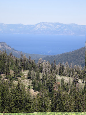
View of Lake Tahoe from the PCT
Zero Day in Reno!!  I heard about Harrah's Hotel and Casino via world of mouth on the trail - at $39/night, Harrahs is cheaper than staying at South Lake Tahoe - even with transportation factored in.  So, after a quick ten mile hike into Echo Lake with Yankee Son and Hallmark, I caught a ride to South Lake Tahoe and then took a four hour bus ride with two transfers to reach Reno.

Walking into Harrah's,  I immediately felt out of place.

Monday, October 8, 2012

Day 68 to 70 - Sonora Pass to Carson Pass

July 2 - July 4
Days 68-70
Miles:  23+21+22
Total Miles:  1084

Camping at Shower Lake on 4th of July
Yankee Son, Hallmark, Just Retired and I got a ride to the trailhead this morning from John.  John was section hiking the PCT and was giving rides to/from Sonora Pass.

This next section is relatively flat and my plan is to do it in three and a half days, and then hitch to Lake Tahoe from Echo Lake on July 5th, and then take a zero.  On July 2nd I made it to a campground by Wolf Creek at mile 1041 camping with YS, HM, JR and two others - Scarecrow and Garrik.  Scarecrow is still sick.  I passed him on the trail today and he looked quite sick and said he may have giardia.

Day 67 - Sonora Pass and Bridgeport

July 1
Day 67
Miles:  6
Total Miles:  1018


I hiked the remaining miles to Sonora Pass this morning (a road pass) and made it to The Owl's trail magic by 10 AM!  After some amazing (i.e.: real) coffee and fruit, a nice couple out for a day hike offered to give a few of us a ride into Bridgeport.  Last on the Bus, Power Nap and I made it into Bridgeport and joined Quest and Rapunzel in a room at the Bridgeport Inn.  I slept on the floor but didn't mind because it was cheap!

Food was great in Bridgeport - lunch at the Sportsman's Bar and Grill, Dinner at Rhinos and Breakfast at a great little cafe down the street.  We also hooked up with Yankee Son, Hallmark and Just Retired.  All-in-all this was a great Nero - I feel totally refreshed for the next 3-4 day section to Echo Lake.

The Owl's Trail Magic at Sonora Pass

Masa lifting his 70 lbs pack!


Day 66 - Toiyabe National Forest

June 30
Day 66
Miles:  23
Total Miles:  1012


I hiked over Dorothy Lake Pass this morning leaving Yosemite National Forest and entering Toiyabe N.F..  The landscape is changing to a more volcanic landscape - less granite and more rust-colored volcanic rock.  The change is striking and I feel as if I have left the high sierra, though officially this will not happen until I pass the town of Belden in 300 miles.  I am camping up near Leavitt Lake at 10,500 feet tonight.

Day 63 to 65 - Yosemite

June 27-29
Day 63-65
Miles:  7+20+20
Total Miles:  989


Yosemite - A Rock Climbers Heaven

I took my time leaving Tuolumne Meadows.  I ate breakfast and lunch at the grill near the store and then hand-washed my clothes and set them out to dry on the picnic table at camp.  I wanted to hike out with others that I knew but it wasn't to be - many hikers I knew hiked in at 4 o'clock on the day I was leaving and they were staying the night.  Looks like another solo journey for me.  I finally hiked on at 5:30 and walked the seven miles to the Glen Aulin camp - a high sierra backcountry camp next to the beautiful Glen Aulin waterfall.


Yesterday, June 28th, I hiked over Benson Pass at only 10,150 feet.  the high passes are over!  I passed Rapunzel, Quest, Kristo and two others on this day and joined them at camp at Smedberg Lake.  It's an amazing thing about the trail - you never have to be alone for long.  Just yesterday I was lonely and hoping for a hiking partner.  Today, I meet a new group of hikers just one day after leaving Tuolumne!

Today I crossed over Seavey Pass at just over 9000 feet from Benson Lake at 7700 feet.  I then had two more passes to climb:  an 800 foot climb and a 1200 foot climb.  I camped by myself tonight after passing on a campsite at Wilma Lake where Kristo was setting up.  At Wilma the mosquitos were fierce!  Even where I was camped, a mile farther, mosquitos were hard to ignore.  For the first time on my PCT hike I donned my mosquito net.  I also ate dinner in my tent after stealthily cooking through my bug net with my arms outside operating the the stove.


Taking shelter from mosquitos in my tent


Day 62 - Tuolumne Meadows

June 26, 2012
Day 62
Miles: 20
Total Miles: 942


Winds last night near Thousand Island Lake were fierce!  My tent came "loose" twice - I had to reach outside the tent in the middle of the night and tighten the zip lines that were loosened by the constant wind batting against my tent.  While doing this I tore a hole in the fabric of the air vent because I misplaced the support pole (my trekking pole) before tightening the line.  In the morning, after a restless night, I woke up to clear and calm skies.
I made it Tuolumne Meadows in Yosemite National Park today after crossing over Donahue Pass, the last 11,000+ foot pass in the Sierras.  The last 10-12 miles were relatively flat after I descended down the pass.  I crossed a stock caravan twice on the descent before realizing that I packed up and hiked in the wrong direction after lunch!  I think my mind was distracted by the possibility of reaching Tuolumne and the restaurant and general store.  After realizing my mistake, I hiked double-time to make it to Tuolumne before they closed at 4 - catching up the same caravan of horses/mules that I had walked by on the pass (now heading back to Tuolumne).  I knew their pride was bruised that a hiker could pass, much less keep up with, the riders on their "high horse"!  They didn't know I was hiking for food and  under-estimated a hungry hiker's stamina!  As I was approaching from behind they looked back every so often to see if I was still there.  Each time I grew closer and closer to the stock train and wondered what I was going to do to get around a dozen easily-spooked animals.  The hose team finally stopped and let me pass, and with a couple of nods I was hiking off faster than before with nothing to keep me from a stocked store or burger at the restaurant.

Stock Train on the PCT near Tuolumne Meadows

I made it 15 mins before the restaurant was supposed to close - but it was the wrong restaurant, an outdoor cloth napkin affair at the lodge that was only open for reservations!  After some confusion and asking around I realized that the restaurant that closed at 4 was down the main road - a short bus ride away.  I jumped on the free shuttle bus and arrived at the restaurant too late.  The store, however, was thankfully open and I pulled as much pre-packaged food off the shelf as I thought I needed and walked outside to join other hikers lingering at the benches across from the parking lot.  Soon I was on my way to the campground behind the store.  After a reunion with Desert Fox and Masa at the campground I was running back to the store for beer and ice-cream.

It's been lonely on the trail the past few days and I hope I can hike out with some others after a rest day.


Tuesday, September 18, 2012

UPDATE - SEPT 17, 2012

Hello Friends,

I am currently at mile 2402 of my 2650 Pacific Crest Trail Thru-Hike - enjoying a room at the Snoqualmie Summit Lodge!  I have been unable to update my blog regularly during this second half of the hike.  I will be completing all updates after I finish on approximately October 1st - just a couple of weeks from now!!

It has been an amazing adventure and I look forward to sharing it with you as soon as possible.  Thanks for reading and thanks for your patience!

-Morrissey (Russ)


Friday, August 3, 2012

Day 61 - Devil's Postpile

June 25, 2012
Day 61
Miles: 15
Total Miles:  922
Devil's Postpile rock pile

Breakfast at the Red's Meadow Cafe - french toast and eggs!  If I blog a lot about food on the trail, please understand that i am ALWAYS hungry.  It's not uncommon for me to eat 3,000 calories at a sitting when i am in town.  This does little to offset the massive calories I burn hiking 20-30 miles a day.  Anytime I can get a real meal is a treat.

I hiked the JMT alternate route after stopping to see the Devil's Postpile - octagonal basalt columns left exposed from glacier activity.  This is one of the best examples in the world of these columns, the other being somewhere in Great Britain. 


I hiked the JMT alternate section from mile 909 to 922 and then rejoined the PCT at Thousand Island Lake.  The Halfmile maps showed a campsite at this lake and I searched desperately for something flat and out of the wind but was ultimately unsuccessful - disappointing after a long day of slogging through some dense forest on the trail.  When I have my heart set on a stopping point and it there turns out to be no suitable camping, it is really a let down.  I hiked a mile past the lake and found a spot over-looking the lake where the winds were not as severe.  Even so, this turned out to be one of the windiest nights I have experienced.


Today was quite lonely walking by myself.  I feel I'm in a vacuum of sorts.  I hope to meet up with other hikers at Tuolome Meadows.

PCT Northern Terminus

PCT Northern Terminus
On September 30, 2012 I reached the Northern Terminus of the Pacific Crest Trail. Thanks to everybody who supported and followed my journey. It was a life-changing experience!